Watershed Maps and Directions
Our watershed properties extend to eight areas for recreational activities. Find information about each area and directions on how to get there.
Our watershed properties extend to eight areas for recreational activities. Find information about each area and directions on how to get there.
September 8, 2025 - The Brighton Dam Azalea Garden will be closed on Wednesday, September 10, 2025.
Effective September 8, 2025, credit card convenience fees for watershed permits will change from $1.69 per payment to 2.5 percent per payment. Check (ACH) convenience fees will change from $1.69 per payment to $2.35 per payment.
September 4, 2025 - Big Branch and Pigtail boat ramps are closed to trailer access due to current water level.
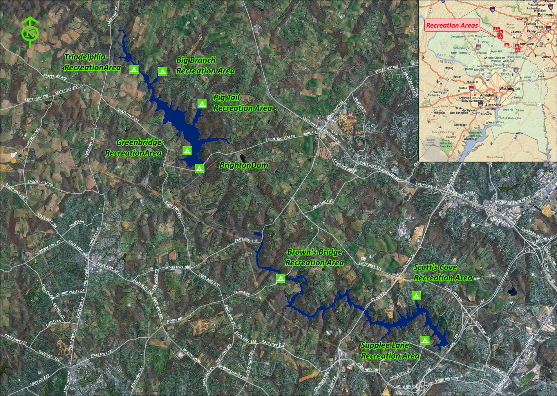
| Location | Address | Boat Ramp | Picnic Tables | Playground | Grills | Moors for Rent | Handicapped Pier | Plant List |
| Browns Bridge Recreation Area | 2220 Ednor Road Silver Spring, MD 20905 | X | ||||||
| Scott's Cove Recreation Area | 10972 Harding Road Laurel, MD 20723 | X | X | X | X | X | ||
| Supplee Lane Recreation Area | 16601 Supplee Lane Laurel, MD 20707 | X | X | X | X | X | ||
| Big Branch Recreation Area | 14801 Triadelphia Mill Road Dayton, MD 21036 | X | X | X | X | |||
| Brighton Dam | 2 Brighton Dam Road Brookeville, MD 20833 | X | X | X | ||||
| Greenbridge Recreation Area | 2800 Greenbridge Road Brookeville, MD 20833 | X | X | |||||
| Pig Tail Recreation Area | 5600 Green Bridge Rd Dayton, MD 21036 | X | ||||||
| Triadelphia Recreation Area | 2600 Triadelphia Lake Road Brookeville, MD 20833 | X | X | X | X | X | X |
|
As per WSSC Water Watershed Regulations:
WSSC Water reserves the right to close a portion of, or the entire, watershed without prior notice if:
At its sole discretion, WSSC Water may change these regulations for any other reason as needed.
Please call (301) 206-4386 (4FUN) before making any watershed permit purchases to ensure the reservoir you’d like to use is currently open for recreation